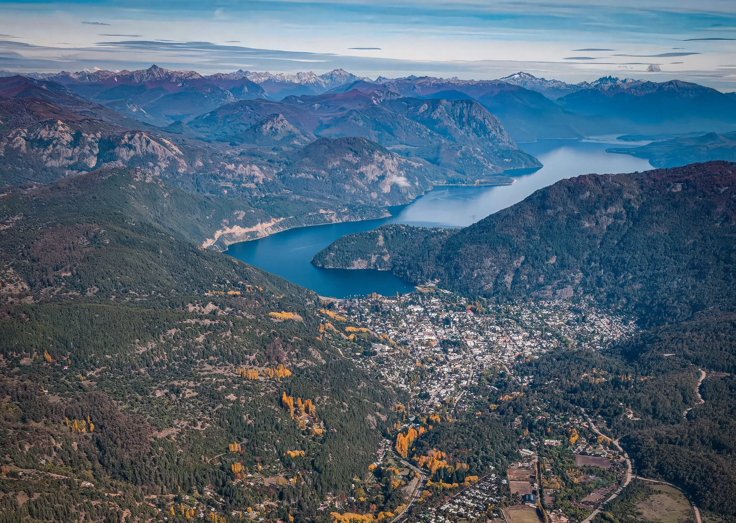
Read the land before acting
Before any intervention, the design listens: basin, slope, exposure, fire risk, native forest, access, and social license. The current work is analysis and ground-truthing, not public map display.
Land analysis activities underway
Watershed reconnaissance
Confirm drainage lines, seasonal flow paths, riparian buffers, and water-access constraints before any site planning assumptions are made.
Slope and exposure reading
Walk and classify buildability by grade, solar exposure, wind, frost pockets, erosion sensitivity, and winter access conditions.
Native forest and habitat baseline
Identify pehuén, Nothofagus stands, red-category OTBN constraints, wildlife corridors, and areas that should remain untouched or enter active restoration.
Fire and defensible-space review
Translate wildfire history, fuel loads, evacuation logic, and defensible-space requirements into first-order design constraints.
Cultural and access due diligence
Coordinate the Story of Place, Curruhuinca social-license process, trail/access sensitivities, and no-go areas before any development narrative advances.
Infrastructure fit check
Assess road approach, water, wastewater, energy, emergency access, and low-impact construction logistics without exposing parcel-level GIS publicly.
Layers
Basin & water
Lácar basin (~1,048 km², Pacific-draining via Hua Hum). Use regime under Neuquén's Water Code (Law 899/1975): lakebed and bank are provincial public domain.
Native forest (OTBN)
Forest Law 26.331 zoning: red-category forest is effectively undevelopable. The parcel's OTBN class is obtained before any transaction.
Fire risk
A wildfire-risk and defensible-space plan as a first-order design constraint, after the 2024–25 season.
Park adjacency
Lanín NP boundaries (~216,000 ha): no development inside the park; adjacency is the market asset.
Geographic source files are being used internally for diligence. Public spatial display is intentionally withheld until boundaries, constraints, and cultural permissions are confirmed.